<--Google tag--> <--Google tag end-->

About Milpitas

Weather in Milpitas, California-Forecasts and History

See our weather forecast widget on every page in the lower right column. It includes hourly forecasts and you can click through to minute by minute forecasts so you know when a storm cloud is about to dump on exactly where you are.

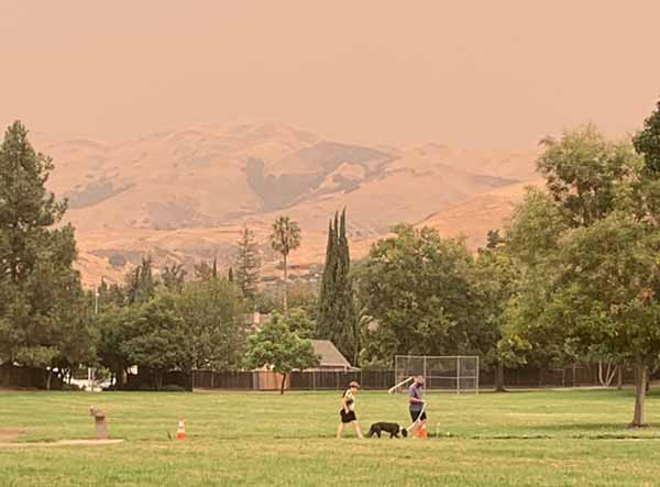
Apocalyptic Wednesday!.

Orange Sky 9-9-2020
Dog still needs to be walked in spite of smoke in the air.

Forecasts

The Weather Channel
Hourly weather forecast for the Milpitas area, with other links to maps, travel conditions, gardening and allergy tips, advisories for those flying or boating. You may change settings.

Spare the Air
Click here to see if it’s a good idea or not to light a fire in your fireplace tonight. Runs from November 1 through February.

Wunderground: Milpitas 5-day Forecast
Also conditions at area airports, large and small.

Current

Where smoke was coming from.

Rainfall Maps from DWR/CNRFC
San Francisco Bay 1 Hr, 6 Hr, 24 Hr

US National Weather Service San Francisco Bay Area/Monterey California
Facebook posts do not always reflect the most current information. For current official info, visit: Local Forecast Office for San Francisco Bay Area/Monterey, CA.

Confronting Climate Change in California
As we enter the 21st century, a powerful new agent — global climate change — will increasingly interact with the human pressures that continue to stress California’s natural environments. From the Union of Concerned Scientists.

Area Vibes: Milpitas CA Weather
For today and the coming week, as well as historic averages for each month. Lots of other data about Milpitas you may want to know.

Which City Has The Most Unpredictable Weather?
Not Milpitas! San Francisco’s weather patterns are unusual as compared to the rest of the country (September has historically been San Francisco’s warmest month, for instance). But they’re predictably unusual, at least on a day-to-day (if not necessarily hour-to-hour) basis. And San Francisco, like the rest of the West Coast, rarely gets severe weather. In other words, it is fairly easy for the weather forecast you see on TV to be correct.

Drought in San Francisco Bay Area

Burned hillside in Milpitas
Fire on the hillside during July heatwave

Inside Bay Area Drought
News, water saving tips, maps and data, on how drought is affecting the Bay Area.

Historic Weather Events

Storm Events Database
Search Results for Santa Clara County, California. 397 events were reported between 01/01/1980 and 01/31/2018 (13911 days). Sortable data base. You can also change the date range to suit your study. Due to Trump cuts to the NOAA budget, the data hasn’t been collected for several years.

Sunnyvale Tornado 1998
Tornadoes are extremely rare here, but one did occur in 1998. This one did some destruction in Sunnyvale. Here’s the weather analysis from SFSU.

Wind Storm, October 22, 2000
GO MILPITAS ARTICLE
Photo essay by your Go Milpitas! Guide, Ann Zeise, showing damage done by windstorm.

Images

Mt Hamilton HamCams
We’ve added a second, fixed Hamcam (Hamcam #2) to provide the popular and useful western view, thus freeing the original Hamcam (Hamcam #1) to roam the mountain top at our whim.

Night Sky

Planets Visible in the Night Sky in San Jose, California, USA
Clear enough to see the stars tonight? Here’s what planets you’d see tonight.

2020 Perseid Meteor Shower: Peak Dates For Bay Area
The annual Perseid meteor shower is known as the fireball champion of meteor showers and can be seen over The Bay Area for most of August.

Winter Storms

Winter Storm in Milpitas Hills
Monument Peak and Summitpoint homes in the snow one cold March day.


Earthquakes

California earthquake faults and recent earthquakes, and how they affect Milpitas, San Jose, and the San Francisco Bay Area.

Did You Feel It?
This is a U.S. Geological Survey project to collect information about ground shaking following significant earthquakes. Following an earthquake, please tell us what you felt by filling out the questionnaire for the appropriate earthquake. Best site to find information about a very recent earthquake.

Advice
Earthquake Information
Earthquakes Recently
History
Kids Earthquake Links
Maps
Public Seismic Networks

Advice

Are you ready for an earthquake?
The next time disaster strikes, you may not have much time to act. Prepare now for a sudden emergency. Learn how to protect yourself and cope with disaster by planning ahead. From the Red Cross.

Earthquake Engineering
National Information Service for Earthquake Engineering provides this technical site to provide latest research on how to build in a fault zone.

Earthquake Program
The City of Milpitas Building and Safety Department has a program to help you make your house safer. We will provide interested homeowners with a Prescriptive (Cookbook) Plan Set that may be used to strengthen older homes and for obtaining their building permit.

Make your own earthquake preparedness kit
In order to prepare for a major earthquake, SFGate has compiled a list of supplies the American Red Cross recommends you keep on hand.

Protect Yourself During an Earthquake…Drop, Cover, and Hold On!
OFFICIAL RESCUE TEAMS from the U.S. and other countries who have searched for trapped people in collapsed structures around the world, as well as emergency managers, researchers, and school safety advocates, all agree that “Drop, Cover, and Hold On” is the appropriate action to reduce injury and death during earthquakes.

Protecting Your Family From Earthquakes–The Seven Steps to Earthquake Safety (in English, Chinese, Vietnamese, and Korean)
Developed by American Red Cross, Asian Pacific Fund, California Earthquake Authority, Governor?s Office of Emergency Services, New America Media, U.S. Department of Homeland Security Federal Emergency Management Agency, and U.S. Geological Survey.

Putting Down Roots in Earthquake Country
This popular 32-page earthquake science and preparedness handbook has recently been updated. The new version features current scientific understanding of when and where earthquakes will occur in California, and how the ground will shake as a result. Updated maps of earthquakes, faults, and potential shaking are included as well as instructions on how to get information after earthquakes.

Earthquake Information

ABAG Resilience Program
Analysis of Bay Area hazards and how we can prepare for a bad quake.

California’s Earthquake Forum
The home for California earthquake information. A place to ask geologists about western fault information.

Earthquake Outlook for the San Francisco Bay Region 2014–2043
72% probability of one or more M ≥ 6.7 earthquakes from 2014 to 2043 in the San Francisco Bay Region. Earthquakes this large are capable of causing widespread damage; therefore, communities in the region should take simple steps to help reduce injuries, damage, and disruption, as well as accelerate recovery from these earthquakes.

Northern California Earthquake Data Center
The NCEDC is a long-term archive and distribution center for seismological and geodetic data for Northern and Central California.

Recent Earthquakes in California and Nevada
Earthquakes recorded for the last week (168 hours). Times are local (PST or PDT). The most recent earthquakes are at the top of the list. Click through for details.

UC Berkeley Seismological Laboratory
You can even make your own seismogram!

History

1906

The Great 1906 Earthquake And Fire
Original sources and timeline from the Museum of San Francisco.

Story of an Eyewitness
Collier’s, May 5, 1906. Jack London went to the scene of the San Francisco Fire & Earthquake and wrote the following dramatic description of the tragic events he witnessed in the burning city.

1989

1989 Earthquake Reports and Photographs
Fascinating original source material from the Museum of the City of San Francisco, such as 911 reports, photographs, and more.

The October 17, 1989, Loma Prieta, California, Earthquake-Selected Photographs
This publication provides images for use by the interested public, multimedia producers, desktop publishers, and the high-end printing industry.

1998

Mission Peak Landslide of 1998
Report of the engineering firm retained by the City of Fremont to make a preliminary evaluation of the landslide sufficient to guide the city in emergency response and future planning decisions. (Picture)

Kids Earthquake Links

California Has Its Faults
A fault is a fracture along which there is movement. Some faults are actually composed of several fractures called fault branches. Collectively the branches are a fault zone.

Candy Quakes
A lesson plan using a variety of candy which you will quish in a number of ways to demonstrate forces on earth rocks. Clean up is the best part.

Make Your Own Earthquake Crossword Puzzle
Add, edit, delete clues, and customize this crossword. Print copies for an entire class. All in 5 minutes.

FEMA for Kids: Earthquakes
Most of the time, you will notice an earthquake by the gentle shaking of the ground. You may notice hanging plants swaying or objects wobbling on shelves. Sometimes you may hear a low rumbling noise or feel a sharp jolt. The computer simulations include a total of seven earthquake scenarios: three magnitude 6.8 scenarios with different starting locations (epicenters), three magnitude 7.0 scenarios with different starting locations, and one magnitude 7.2 scenario.

Maps

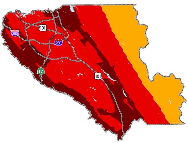
Santa Clara County Earthquake Hazard
Milpitas located in area where freeways make a capital H

ABAG’s Resilience Program – Earthquake Map Santa Clara County
Several active faults present potential hazard to Santa Clara County. On the northwestern boundary, the San Andreas Fault runs through the hills separating the County from Santa Cruz County. In the central county, the Hayward/Rodgers Creek and Central Calaveras dominate the earthquake threat. The Greenville fault dominates in the northeastern portion of the county.

Bay Area Shaking Hazard Maps
The “On Shaky Ground” supplement report lets you select a city (say, Milpitas) and a large quake on a number of Bay Area fault lines. It then shows you a map of how intense various neighborhoods would feel that quake.

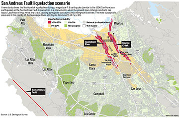
San Andreas Fault Facts
California’s sleeping giant, the San Andreas Fault, marks the slippery yet sticky boundary between two of Earth’s tectonic plates. It is responsible for the biggest earthquakes in California, up to at least magnitude 8.1.

San Andreas Fault Liquefaction Scenario

Santa Clara County Earthquake Hazard
Several active faults present potential hazard to Santa Clara County. On the northwestern boundary, the San Andreas Fault runs through the hills separating the County from Santa Cruz County. In the central county, the Hayward/Rodgers Creek and Central Calaveras dominate the earthquake threat. The Greenville fault dominates in the northeastern portion of the county.

Public Seismic Networks

Public Seismic Network of San Jose
Dedicated to the promotion of awareness and information about earthquakes. It is part of the growing worldwide PSN which connects amateur seismologists, persons interested in earthquakes and seismic activity with information resources; from general history to detailed plans for constructing monitoring instruments and systems.

Guides to Silicon Valley Civic Networks

Before Google Local, small cities relied on such guides to Silicon Valley and else where. The project was called civic networking, and GoMilpitas was one of these very early civic network sites. Many civic networks still exist, each giving a unique view of their local scene in a way Google cannot.
Civic Networking
Civic Networks: Building Community on the Net
By Scott London

About Civic Networking

Zeise’s site is a one-woman operation that’s truly a grass-roots effort. Zeise, who believes a community guide can’t be done properly unless its creator lives in the town it covers, attends Chamber of Commerce meetings and watches city council meetings on television. by Deborah Kong, Mercury News. Read whole article.

The primary aim of this site, GoMilpitas.com, is not to make a significant profit, just enough to pay its bills. The ads pay the bills…just. The whole point of this site is to encourage all of us to work with each other, to connect to make purchases or exchange ideas with each other, and to make Milpitas a truly great small city. No local concern is ever charged for a link on this site, but some businesses may wish to appear on multiple pages, and we are set up to place their ads at a reasonable price.

GoMilpitas.com is under extreme competition from search engines like Google Local and review sites like Yelp, both of which have done their best to kill community networks where locals can determine what the most useful resources are in their towns. This is why I encourage you all to use the links you find on this site to explore resources that interest you in Milpitas. Use this page to look for things in other nearby cities. Support community networks everywhere rather than Google or Yelp. Tell the businesses you connect to that you found their resource on GoMilpitas.com, and drop a plug to advertise on the site so it can stay vibrant.

The Community Network Movement
Realizing that communication and information are increasingly dependent on networked digital information, community activists all over the world ­ often in collaboration with government agencies, non-profits, or businesses ­ are developing community computer network systems.

Central Silicon Valley Civic Networks

Campbell
City site has many features of a good community website.

Cupertino
Mayor Sandra James says the entire community works together to provide the kind of community everyone desires. “Partnerships are what we [in Cupertino] are all about.”

Discover Milpitas
An attempt to rebuild GoMilpitas.com from scratch. Has a lot of things labeled as being in Brea. Looks pretty, but lacks content.

East Palo Alto
For most of its history, East Palo Alto was part of unincorporated San Mateo County. As such, it did not have an official boundary until it incorporated in 1983.

Los Gatos, California, USA
Helpful information for travelers and visitors is available, including maps of the area, pictures of the town, and lists of businesses with contact information. Interesting facts have been collected to provide you with “inside information.” You can even check the weather!

Palo Alto Online
Things to do and places to go in lovely Palo Alto.

San José
City government’s website.

San Jose Chamber of Commerce
The Chamber is the largest business organization serving the Silicon Valley.

San Jose.com
San Jose retains the small town heart of its orchard days when, it has been said, the only chips contemplated were left behind by wandering cattle. Metro’s website.

San Jose Convention & Visitors Bureau
Complete information on attractions, visitor travel and upcoming events in San Jose, California.

San Jose Downtown Association
The heart of Silicon Valley is experiencing a renaissance of culture and commerce. The 11th largest city in the United States has a world-class downtown. Come see for yourself.

Saratoga
A compendium of resources, – including wineries – news, events and weather presented by Dave Delgado.

Santa Clara
Whether you are new to Santa Clara, or a long time resident or business, our Web site is designed to help you learn about services provided by the City, and where you can obtain additional details.

Sunnyvale
Known as the “Heart of Silicon Valley,” Sunnyvale combines the advantages of an attractive suburban setting, a diverse population, metropolitan cultural opportunities, and a dynamic high-technology industrial foundation.

The Penninsula (San Mateo County)

Coastside Live
Half Moon Bay Coastside’s directory including El Granada, Moss Beach, Montara, San Gregorio, La Honda & Pescadero.

Los Altos
Tree lined streets and a small village atmosphere characterize Los Altos which is located in the heart of world famous Silicon Valley. Just 40 miles south of San Francisco, Los Altos is a residential community served by seven small retail areas. The seven square mile city is developed with small businesses, schools, libraries and churches.

Los Altos Hills
The Town of Los Altos Hills is located in the Northern portion of California’s Santa Clara County, situated between San Francisco and San Jose, just Southwest of Stanford University (Palo Alto, California).

Millbrae
The City of Millbrae is located on the Peninsula, 15 miles south of San Francisco. Chamber Site.

Montara
Surfers’ paradise located just north of Half Moon Bay on the coast just south of San Francisco.

Portola Valley
Home to 4400 people living in 1500 households, Portola Valley, California sits in a green and golden valley, astride one of the most dangerous earthquake faults in the world.

San Mateo
City services and events. Official city site.

San Mateo County
Our purpose in County government is to protect and enhance the health, safety, welfare and natural resources of the community.

San Mateo County Convention & Visitors Bureau
Gorgeous natural scenery, attractions, showplace homes and colorful fields and gardens offer a feast for the eyes. All this, plus fine dining, entertainment, shopping and accommodations to fit every budget, make San Mateo County the place for a memorable California meeting or vacation.

South Skyline Association
The purpose of the South Skyline Association is to foster a sense of community spirit, to keep residents and property owners informed of public agency actions or other items of concern in the South Skyline sphere of influence.

South End

Gilroy Visitors Site
Gilroy, California is famous as the Garlic Capital of the World, hosting the annual Gilroy Garlic Festival. Gilroy gives visitors a friendly, small town character with affordable places to stay, great restaurants, wineries, breweries, world-class shopping at Gilroy Premium Outlets factory stores, attractions and recreational opportunities for the whole family.

Hollister
Somethings almost always shaking in Hollister, but this lively community site makes you want to move in anyways. San Benito County.

Morgan Hill
With a population of 33,000, Morgan Hill is located just south of Silicon Valley. Combining great country living with well-known manufacturing and research firms, Morgan Hill prides itself as the “Small town that’s big on business”. Here is the Chamber Site.

South Alameda County

Livermore / Pleasanton & Tri-Valley
eLivermore.com / ePleasanton.org is a community service of Holy Cross Lutheran Church providing information and links to the Livermore and Tri-Valley areas.

Newark
Newark is located in Silicon Valley on the east side of San Francisco Bay. Part of one of the most dynamic urban areas in the world, Newark has maintained a strong and proud spirit rooted in community values.

Sunol.net
Disclamer: This web site is non-commercial and the sole property of Derek Johnson. Nobody pays me to put anything in it. I’ll add what I want, whenever I feel like it (or get around to it, whichever comes last). I disclaim any knowlege of what I am talking about.

Monterey Bay Area

Monterey – Explore
Once a hub of industry, the centerpiece of Monterey–Cannery Row–has been famously revitalized into a complex of world-class restaurants, hip boutiques, and trendy bars.

Pelican Civic Network
A civic network of community groups and people who care about natural and cultural history. Covers from Davenport to Morro Bay.

Santa Cruz City
Located on the sunny side of the beautiful Monterey Bay, 74 miles south of San Francisco. On this site, you will find information about City government, City departments, services, and programs.

Santa Cruz County
Many members of the Santa Cruz area have their own websites as part of “cruzio.com.”

Santa Cruz County
Official county website. Explore our majestic redwood forests and vibrant cityscapes. Taste our fresh cuisine and fine wines. Experience our rich history, acclaimed arts, and year-round events for everyone. In Santa Cruz County, our beaches are just the beginning!

California Community Websites

Berkeley Parents Civic Network
This web site contains thousands of pages of recommendations and advice from the Berkeley Parents Network, a parent-to-parent advice newsletter for the community of parents in the Berkeley, California area. Not limited to just Berkeley.

Davis Community Civic Network
Community resources for this college town in the Sacramento Valley.

East County Live
Civic network that serves Antioch, Pittsburg, Oakley, Brentwood, Byron and Discovery Bay.

Los Banos
Now a Facebook group with regular postings.

Napa Valley
Visit wine country. Covers Calistoga, St.Helena, Oakville/Rutherford, Yountville, Napa and Outlying Areas.

Petaluma Visitors
Locate things to do, and particpate in their many discussion boards. Vote on hot topics!

Point Richmond Online
Neighborhood site to bring a community together.

California Community Networks

There are a good number of free and low cost community networks in California.

KCBXnet formerly SLO Net
SLONET Regional Information Network – San Luis Obispo and northern Santa Barbara counties in California. Site has excellent internet use training course materials available.

Mendocino Community Network
A civic network owned and operated by the Mendocino Unified School District for the purpose of supporting our District’s Internet Node and to benefit our local and global communities. MCN price for residential basic DSL service is now just $14.99 for the first six months. Service now available in the Sacramento, Monterey, Salinas, Chico, Chowchilla, Stockton and LA areas! In the fall DSL is coming to the Kelseyville/Upperlake area.

Napa Net
Offers internet services to residents of Napa, California, including DSL services and virus-free email.

Silicon Valley Public Access Link
A non-profit computer network which makes on-line information accessible to people living in the Silicon Valley regardless of financial status and educational level.

Silicon Valley Unwired
Ten years ago, Milpitas’ free municipal wireless Internet system was a novel idea involving state-of-the-art technology that sought to provide greater web access to the community. A decade later, Milpitas’ citywide Wi-Fi system and its attendant equipment is still in place but now sits mostly unused.

SonicNet
A low-cost ISP as well as a comunity information website for those in Sonoma, California.
Computer History

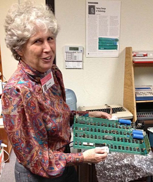
Liza Loop showing me the first Apple computer that Wozniak personally gave to her. Yes, it is just a PC board, no case, but it still works when hooked up to a power supply, keyboard, and a monitor. It was kept in Milpitas for many years until the Sobrato Center kicked out the little museum. This photo was taken in Milpitas.

Liza Loop and the First Apple

Apple II History
This project began as a description of how the Apple II evolved into a IIGS, and some of the standards that emerged along the way. It has grown into a history of Apple Computer, with an emphasis on the place of the Apple II in that history. By Steven Weyhrich.

Atari Games Museum
The following pictures were taken in May of 2003, when Midway decided to close their Milpitas facility. The Milpitas facility was the old ‘Atari Games’ building. I was able to get some pictures, before everything was moved out of the building.

Chief Yahoos: David Filo and Jerry Yang
“Don’t put off until tomorrow what you can postpone to the day after.” This parody of the old proverb could very well be the motto of Yahoo! Inc. co-founders David Filo and Jerry Yang. By following such a philosophy of procrastination, they not only created the world’s most popular (and most profitable) World Wide Web search engine; they also made themselves multimillionaires in the process. Well, sort of.

Computer History Museum
Timeline of computing history, browse by topic, or send them information about computing history. Located in Mt. View.

Don Hoefler
The journalist credited with coining the phrase: “Silicon Valley.”

Folklore
Andy Hertzfeld’s book in blog format. Read about the origins of Apple and the Macintosh computer.

GoMilpitas Way Back
This site has archived my home page and some internal pages since 1999. If you’d like to see news headlines and such, take a look here.

Apple I replica creation: back to the garage
By Tom Owad. A Google book preview.

History of Computing Industrial Era 1976 – 1979
The Third Generation of computers starts approximately in this era. These computers are characterized by mainly electronic models but now fully programmable. From The History of Computing Foundation.

Homebrew Computer Club
That summer in 1975 at the Homebrew Club the Intel 8080 formed the center of the universe. The Altair was built around the 8080 and its early popularity spawned a cottage industry of small companies that either made machines that would run programs written for the Altair or made attachments that would plug into the various kinds of micro computers. Be sure to check out the early newsletters.

IBM’s Early History
In 1890 the U.S. Census Bureau knew its traditional methods of counting would not be adequate for measuring the population, so it sponsored a contest to find a more efficient means of tabulating census data.

IBM Through the Years
A timeline that begins in 1885 with short articles about this history of this business machine company.

An Illustrated History of Computers
The first computers were people! That is, electronic computers (and the earlier mechanical computers) were given this name because they performed the work that had previously been assigned to people. By John Kopplin.

Intel Museum
So you have “Intel Inside.” What exactly DO you have inside your computer?

The Jargon Dictionary
A comprehensive compendium of hacker slang illuminating many aspects of hackish tradition, folklore, and humor. This file, jargon.txt, was maintained on MIT-AI for many years, before being published by Guy Steele and others as the Hacker’s Dictionary. Many years after the original book went out of print, Eric Raymond picked it up, updated it and republished it as the New Hacker’s Dictionary.

Lawrence Livermore Labs History
The single event that triggered the establishment of Lawrence Livermore was detonation of the first Russian atomic bomb in 1949.

Lo*op Center
Once located in the Sobrato Center in Milpitas, under the direction of Liza Loop, documents, artifacts, and stories were preserved to tell the history of educational computing.

Memoir of a Homebrew Computer Club Member
Posted on a bulletin board in the PALY terminal room (containing 6 noisy KSR-33 teletypes in the Palo Alto High School math-science office) was a notice that a computer group meeting would be held at the home of Gordon French. By Bob Lash.

National Semiconductor History 1959 1960’s
National Semiconductor started by making silicon mesa transistors for industrial and military uses. The company grew quickly after 1967 under CEO Charlie Sporck and new management, moving headquarters from Danbury, Connecticut, to Santa Clara, California in the heart of today’s Silicon Valley.

Pong Story
The video game history started in a strange and complicated way and it is important to avoid confusions with what happened in the 1950s and 1960s. The real video game history started with Ralph Baer as early as 1951.

The Promise: An Educator’s History of the Internet
An investigation into the history of the Internet and the promise for its use in the K-12 classroom.

Silicon Genesis
A unique collection of oral history interviews with pioneers of the semiconductor industry.

Steve Paul Jobs
Like the Bhagwan, driving around Rancho Rajneesh each day in another Rolls-Royce, Jobs kept his troops fascinated and productive. The joke going around said that Jobs had a ‘reality distortion field’ surrounding him. He’d say something, and the kids in the Macintosh division would find themselves replying ‘Drink poison Kool-Aid? Yeah, that makes sense’. – Robert X. Cringely, 1992.

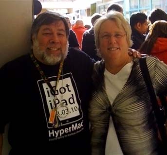
Woz and Ann picking up new iPads April 3, 2010

Steve Wozniak, Still Fathering the Computer Revolution
He’s been called the Wizard of Woz. It was he who single-handedly designed an entire personal computer, the Apple I. It was he who designed the Apple II and wrote the software to make it run. Site has more good Woz sites, including Steve’s own website.

Pioneer Era – 1800s in Silicon Valley

In the 1800s the Mexicans, the Gold Rush, the Civil War, and the Transcontental Railroad transformed the Bay Area from a bunch of sleepy cattle ranches to a booming economy.

Read More About the California Pioneer Era

Milpitas Images of AmericaMilpitas
Images of America
by Robert Burrill
$21.95 or $25 with author signature.
Call 263-5468 to order.
Robert L. Burrill, Milpitas filmmaker and photography teacher for more than 35 years, has combed the archives of the Milpitas Historical Society, private local collections, and his own works to find more than 200 vintage photographs chronicling the heritage, enterprise, and wit of Milpitas from the 1700s to the present day. Read first 31 pages of this book.

Little CornfieldsLittle Cornfields
Hardcover editions of Milpitas : The Century of Little Cornfields 1852 – 1952 by Patricia Loomis are available by making a donation of $18 (or more) to the Milpitas Historical Society. Paperback edition is available for $8.

You are invited to attend one of the Milpitas Historical Society meetings any 2nd Wednesday of each month in the Library at 7p when this book will also be available.

Family Chronicles and Biographies of Milpitas Pioneer Families

  • Abel, George E.
    Born in Milpitas January 3, 1882. Butcher, farmer.
  • Ashley, Aldace N.
    Born in Placer County May 13, 1864. Ashley & Co. General merchandise store in Milpitas.
  • Ashley, John T.
    Born in Vermont June 4, 1830. Father of Aldace and others. Dixon & Ashley merchandise store in Milpitas.
  • Bellew, Michael
    Born in Meath County, Ireland, in 1830. Took up farming in Milpitas in 1861.
  • Boyce, David S
    Born in Quebec, Canada, August 18, 1838. Settled in Milpitas in 1863. Blacksmith and carriage maker. Firm name Boyce & Topham.
  • Brandt, Charles
    Born November 22, 1867. School board member for the Laguna School District in the Milpitas hills.
  • Darling, E. W.
    Born in Quebec, Canada, December 28, 1834. In 1875 Mr. Darling erected the Milpitas grain warehouses.
  • Giacomazzi, Edward P.
    Born in San Jose on March 22, 1879. In 1905, he was appointed the postmaster of Milpitas. Founder of the Bank of Milpitas.
  • Gibson, Edward O.
    Pioneer farmer and stockman.
  • Pashote Family
    Opereated a store, auto truck business, restaurant, ice-cream parlor and meat market.
  • Trimble, John
    Born in Missouri Feb. 17, 1828. He raised fruit,berries and grain.
  • Winsor Family
    Pioneer Blacksmiths of Milpitas.

History of Local Pioneers in the 1800s

Almaden Quicksilver Mining Museum
Mining operations in New Almaden first began in 1845 under the claim of Mexican Cavalry Officer Captain Andres Castillero. Castillero discovered that the red rock used by the local Ohlone Indians to paint them and the walls of the Santa Clara Mission was cinnabar, an ore containing mercury. The valuable mercury was needed to process silver in Mexican silver mines.

Alum Rock Park History
California’s first and oldest park. The park which was founded in 1872, was simply referred to as the “reservation.” The name Alum Rock was derived from a huge rock that was believed to contain a high percentage of alum.

Alviso Adobe Park History
The first story of the Alviso Adobe, which is located near the intersection of Piedmont Road and Calaveras Road, was built some time in 1835 by José Maria de Jesus Alviso, who had been granted title to the land on which it stands by the governor of Alta California, José Castro, on September 23,  1835.

Ardenwood Farm
In 1849 George Washington Patterson joined the stream of young men leaving the Midwest for California’s gold fields. His dreams left little room for failure, but after a year and a half of mining he was ill and broke. And so he turned to work he knew well — farming.

The Bear Flag Revolt
With Fremont’s “army” nearby, and belief in the rumor that Castro was gathering forces to expel the Americans, the local settlers became emboldened enough to steal some horses meant for Castro’s army, then to storm Vallejo’s “fort” at Sonoma June 14, 1846.

California As We Saw It
Exploring the California Gold Rush. By Gary F. Kurutz, Curator of Special Collections, California State Library.

California during the Civil War: 10 Facts
While no battles took place on Californian soil, the state has a rich Civil War history. Learn more about the state of California during the Civil War with these ten facts.

Discovery of Gold in California
It was in the first part of January, 1848, when the gold was discovered at Coloma, where John Sutter was then building a saw-mill. A first-hand account.

Fallon House
Restored to how homes looked during the Civil War era in California, you can easily see this home and the Peralta Adobe next door in one trip.

Frémont in the Conquest of California
In the autumn of 1845 Frémont came on his second exploring expedition to California.

Gold Rush – American Experience on PBS
See if you have what it takes to strike it rich in the gold rush! Choose a character and try to strike it rich in our online role-playing game.

Gold Rush Chronicles
Here before you, in a leather-bound book on an old wooden table, is a history of the great California Gold Rush. Discover the colorful stories that lie unfurled on these pages and unlock a taste of that famous era. Learn how the Gold Rush affected the world not so long ago.

Guadalupe River Park
Local historians have always been aware that a settlement known as the Woolen Mills Chinatown was located near Taylor Street between 1887 and 1902.

History of the Donner Party – C. F. McGlashan
The far-famed Donner Party were, in a peculiar sense, pioneer martyrs of California. Before the discovery of gold, before the highway across the continent was fairly marked out, while untold dangers lurked by the wayside, and unnumbered foes awaited the emigrants, the Donner Party started for California.

Felton Homes and History
Felton had its start in 1843 when Isaac Graham transferred his limber mill from the Zayante land grant to the San Lorenzo River at Fall Creek. Local Felton wiki.

Historic Niles
The community of Niles is rich in history and has gained recognition as a truly unique spot in the San Francisco Bay Area.

History of the University of California
The University of California became a “public trust” in 1879 as part of a larger revision of California’s Constitution approved by California voters. Download full text.

History in the Vines: Fremont’s Wine Legacy
From the Spanish-Mission era up to Prohibition, south Fremont (then called the Washington Township), had once been one of the first and most productive wine regions in California.

The Houghton Donner House
156 E. St. John Street, San Jose, and right in the way of the Civic Center expansion, is a late -Victorian Italianate style and was home to two historically important San Joseans, early mayor Sherman Houghton and his wife, Donner Party survivor Eliza Donner Houghton. “Suspicious” fire burns historic Donner Houghton house to the ground in July 2007. More on the Donner Blog./P>

How California Came to be Admitted
The first Legislature assembled on December 15th for temporary organization in San Jose, the new seat of government. Of more significance, doubtless, was the fact that on the following Thursday, December 20, 1849, the State government of California was formally established. By Rockwell D. Hunt, Ph. D

Joseph D. Grant County Park
In 1839, a 15,000-acre Mexican Land Grant was awarded to Jose de Jesus Bernal and was named Rancho Canada de Pala. Jose de Jesus and his two brothers built adobes around a spring-fed pond on a ridge overlooking the Santa Clara Valley.

Juana Briones
A long-living ranchera acquired a large spread in Santa Clara Valley and shared it with others.

Lighthouses of the United States: Northern California
These early lights, like the Point Pinos Light and the Battery Point Light were built in a what was then a typical New England style. Ironically, there are no examples of this style surviving in New England, so the only place to see these traditional New England lighthouses is in California.Laguna Schoolhouse, Milpitas, CA (1865-1943)

Mexican California
Under Mexican rule governors were encouraged to make more grants for individual ranchos, and these grants were to be outright.

Mexican Years: 1822 to 1846
The early 19th century saw growing discontent in New Spain’s society. Revolts started in 1810 and extended through 1821, when a revolution led to formation of the Mexican Republic.

Mt. View History
In 1851, the Castro family built their first home and, later, donated land to the railroad, creating Mountain View’s first flag stop.

Peralta Family and the Rancho San Antonio
The Peralta Family had a huge rancho that encompassed most of the East Bay from present day El Cerrito down to San Leandro.

Santa Clara Valley Mill & Lumber Company – 1870’s
The demand for firewood and building lumber by the citizens and towns of the Santa Clara Valley produced a road over the summit from Saratoga to the San Lorenzo Valley in 1870.

A short history on wine making in California
The story of wine in California begins with the story of the Spanish in California. Vineyard planting in the state began with the Spanish Franciscan Missionaries starting with California’s first mission: Mission San Diego de Alcalá in 1769. Just as palm trees were planted so there would be palm fronds for Palm Sunday, vineyards were planted so there would be wine for communion. That first variety, planted by Father Junípero Serra, became so ubiquitous that it became known as the Mission grape and was the preeminent variety until 1880.

Stanford Lands
The first parcel, bought in 1876, was 650 acres along San Francisquito Creek. Purchase of adjoining parcels ran the total to 8,180 acres, the whole of which was given to the University in the 1885 Grant of Endowment with the stipulation that it never be sold.

William T. Sherman and Early California History
Sherman arrives in California and describes the Monterey area in 1847. Additional links tell of his experiences during the Gold Rush.

The Winchester Mystery House Story
Not long after Sarah returned to her family and home, another tragedy struck. William, now heir to the Winchester empire, was struck down with pulmonary tuberculosis. He died on March 7, 1881. As a result of his death, Sarah inherited over $20 million dollars, an incredible sum, especially in those days. She also received 48.9 percent of the Winchester Repeating Arms Company and an income of about $1000 per day, which was not taxable until 1913.

California History Overview

Milpitas once had an encampment of Ohlone Indians. Two adobe rancheros still stand from the early days of the Spanish. An early motto was “As goes Milpitas, so goes the State!” For centuries, Milpitas has often taken the lead in new ways of living and governance. If you want to live in the City of the Future, with a lively part in California history, too, come live in Milpitas.
California symbols

About Milpitas

The Milpitas Historical Society
General meeting is the second Wednesday of each month, 7 PM, in the assembly room of the Milpitas Community Library.

Four-Part Video Series about the History of Milpitas
Watch this series of videos at the Great Mall Historical Society Exhibit at Entrance 4.

Milpitas: A look back
Outline of Milpitas History from the Mercury News story published on Aug. 27, 2006.

About California

California History and Culture – State Symbols
Here’s where you find all that information for that state report, like state bird or flower.

California History
A major collection of documents from and about California’s rich history. The documents range from books, maps, newspapers, and periodicals, to pictorial materials (including daguerreotypes, lithographs, stereographs, and paintings) and ephemera (such as posters, programs, pamphlets, and sheet music).

California History Online
Lovely California Historical Society website includes geographic information, California natives, early explorers, to modern times.

California as I Saw It: First-Person Narratives of California’s Early Years, 1849 to 1900
The collection covers the dramatic decades between the Gold Rush and the turn of the twentieth century. It captures the pioneer experience; encounters between Anglo-Americans and the diverse peoples who had preceded them; the transformation of the land by mining, ranching, agriculture, and urban development; the often-turbulent growth of communities and cities; and California’s emergence as both a state and a place of uniquely American dreams.

Heyday Books
Publishing books about California history, culture, and literature.


Mark Hylkema: California during the Spanish and Mexican Colonial Periods
Mark begins with the first Spanish explorers conquering the Aztecs, and tells about the Portolá expedition in 1769, when California suddenly went from prehistory to history, like “the flip of a switch.”

Santa Clara County Historical Landmarks
My mother used to call these hunks of stone with metal plaques “Hysterical Landmarks” because so often there is nothing left at the site but the stone! But you’ll find one at the garage where H-P got started and where Noyce invented his first semiconductor. None in Milpitas…hmmmm.

Historical Figures in Early California

Cabrillo
On June 27, 1542, an explorer under Spanish command, named Juan Rodríguez Cabrillo, left the port of Navidad on the Pacific Coast of what is now Mexico and headed north.

Juan Bautista de Anza
Juan Bautista de Anza was the first European to establish an overland route from Mexico, through the Sonoran Desert, to the Pacific coast of California. New World Spanish explorers had been seeking such a route through the Desert Southwest for more than two centuries.

Governors of California
A tribute to the individuals who have served as chief executive of the State of California from 1849 to present.

Notable People of Milpitas
The “Notable People” project adds to our knowledge about the history of Milpitas. For more information, please click on a link located on the right sidebar of the Historical Society’s page.

Russia’s Great Voyages
More than two hundred years ago, Russian naturalists, ethnographers, astronomers, cartographers, geographers and artists first described the west coast of America to the rest of the world.

Sir Francis Drake
The British explorer, Sir Francis Drake, sailed up the coast of California in 1579. Could he have discovered Milpitas?

History of Railroads in California

History of the California end of the Transcontinental Railroad, and other historic trains and historic railroads in the San Francisco Bay Area.


Key System Scrapbook
Key System electric transit in the East Bay area from the beginning to the end of WWII. Also the Richmond Shipyard Railway to the Kaiser Richmond Shipyard.

California Railroad & Trolley Corporation
The mission of the California Trolley and Railroad Corporation (CTRC) is to restore, preserve and interpret railroad equipment as it was used to serve the people in Santa Clara Valley, California.

California State Railroad Museum
A two-hour drive to Sacramento is not too far for most railroad buffs to travel to see this tribute to the transcontinental railroad which had its terminus here.

Central Pacific Railroad Photographic History Museum – Transcontinental Railroad
“The visionary Theodore Judah laid the engineering groundwork, but Samuel Montague and Lewis Clement carried it over (and through) the great granite peaks, across the Donner Pass and down the Truckee Canyon.”

Golden State Model Railroad Museum
They have these huge dioramas within which the trains run. Located at 900-A Dornan Drive, Point Richmond, California, close to the east end of the San Rafael bridge (I-580) in the northeast corner of the San Francisco Bay area.


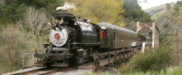
Niles Canyon Railway

Niles Canyon Railway
An operating historic railroad museum on the last link and LAST SPIKE of the Original Trancontinental Railway, takes you back in time aboard the railways of the past.

Niles Canyon Transcontinental Railroad Historic District
Made up of the 11 mile-long section of the First Transcontinental Railroad that passes through Niles Canyon between the towns of Sunol and Fremont (Niles), north of San Jose, California. The rail line through Niles Canyon to San Francisco was the final segment of the First Transcontinental Railroad and was completed in 1870, providing the first rail connection between the San Francisco Bay area and the rest of the United States.

Niles Depot Model Railroads and Museum
The Niles passenger and freight depots located in the Niles District of Fremont, California, are home to a railroad museum and two new model railroad layouts.

South Bay Historical Railroad Society
Located at the historic Santa Clara Caltrain Depot, and opened periodically to the public for free.

Western Pacific
Probably the most significant event to occur in the history of Western Pacific subsequent to 1953 was the location of the Ford Assembly Plant on company property at Milpitas, California on the San Jose Branch.

The Zephyrettes – A History
Good morning, this is your Zephyrette Jean Williams. On behalf of the Western Pacific, Rio Grande and Burlington railroads, I welcome you aboard the California Zephyr.” With those words, first spoken in Oakland, California on board the first eastbound #18 on March 20, 1949, a grand tradition was born. From the California Zephyr Virtual Museum.

Genealogy Resources in Silicon Valley

Genealogy resources for finding long-lost relations who may have lived in the Santa Clara Valley.

Family Tree

California Pioneer Project
A list of settlers to California who migrated to or were born in California prior to 1880 (included in the 1880 California Census) and obtained from those sent (e-mailed) directly from individuals doing genealogical research.

Genealogy Research in Santa Clara County
This is the place to start researching for your local California ancestors.

Silicon Valley Computer Genealogy Group
Wherever your family history journey leads you, our group of genealogy enthusiasts and experts can help you along the way. We sponsor monthly classes, workshops and seminars in Santa Clara, California, and our members everywhere receive our monthly newsletter. Facebook Group.

Silicon Valley Chapter Sons of the American Revolution
Our organization actively supports the preservation of American history and patriotism by sponsoring historical speech contests for high school students, granting awards to the local ROTC, participating in patriotic events and rewarding outstanding acts of patriotism. Facebook Group.

City Guides Hope Net Users Will See the Sites

In its early days, the Web provided a guide to the far-flung corners of the world — giving avid hikers a glimpse of what it might be like to go bushwalking in Australia, for instance.

Then, a new crop of city guides appeared, with information about hiking trails right around the corner and much more, from local news to the latest entertainment listings.

The only problem: Few people visited the sites, and merchants were reluctant to advertise there.

BY DEBORAH KONG
Mercury News Staff Writer
Posted at 11:21 a.m. PST Sunday, November 7, 1999
Posted on GoMilpitas.com with permission of the Mercury News.

Now, pioneers such as America Online’s Digital City and Ticketmaster Online-CitySearch are redoubling their efforts — expanding into new cities, beefing up content and offering the ability to reserve a spot in local hotel rooms, restaurants and, eventually, even golf tee times.

Other players such as Ezyfind.com are also entering the market, focusing on helping merchants in suburban communities get online.

One factor that’s fueling the change is the growing number of homes with Internet access. They’re a potentially huge audience for small and medium-size businesses that are rushing to set up virtual storefronts before competitors do.

“Local commerce is certainly a burgeoning market. . . . Whoever can get the local commerce market onto the Internet is someone who’s going to make a lot of money in the long run,” said Yankee Group analyst Emily Meehan.

But consumers are picky. City guides that don’t offer a wide range of well-informed content that is continuously updated won’t make the cut, she said.

That’s where a split is emerging between these city guides. While some focus primarily on providing information about a city — event listings and local news, for example — others say the real attraction is providing services to help merchants set up shop online.

Whatever the winning formula turns out to be — if there is one — San Jose State University anthropology Professor Jan English-Lueck said people do turn to the Net to learn about their communities.

“The people who are moving here use that as a major avenue for finding out what’s happening in the community, what’s around them,” said English-Lueck, who is studying how people use technology as part of her research on the relationship between people’s work and lives. “Even if they’ve lived in Los Gatos for 20 years, if they have to find out something about Menlo Park because they’re visiting friends there, then they might use it for local content.”

More than that, people want to “argue about their sports teams with people in their cities,” said Paul DeBenedictis, president of AOL’s Digital City.

The problem for local sites has been not just what kind of content they carry, but also the cost of producing it. Some, like Digital City, have partnered with existing media companies for everything from news stories to restaurant reviews. Others, like Microsoft’s Sidewalk, recently acquired by Ticketmaster Online-CitySearch, hired staff, only to cut back to make the company more efficient.

But now Digital City says it is turning a profit. CitySearch says it is making money on some pieces of its site — online personal ads, for example.

AOL recently announced plans to expand from 60 cities to more than 200, extending its reach beyond major metro centers to areas such as Knoxville, Tenn., Tucson, Ariz., and Savannah, Ga. Its Digital City sites, first launched four years ago, offer entertainment, dining and local planning guides, directory services and local information on health and other topics.

But DeBenedictis said the strength of Digital City lies in content created by its users. That includes, for example, a heated exchange between 49ers fans on a bulletin board in its sports section, or comments about Berkeley culinary temple Chez Panisse, in the Digital City dining section.

“They want to be proud of their city or their town and they want to contribute,” DeBenedictis said. “It’s creating the old town square. You’re allowing them to communicate again.”

Knight Ridder New Media, a business unit of Knight Ridder, parent company of the Mercury News and 30 other daily newspapers in 28 U.S. markets, also hopes to appeal to consumers by emphasizing its community ties and local brands.

“There’s a window for us used to be the Welcome Wagon directory for people on the Web (who are) looking for local information for the first time,” Finnigan said. “Four years from now, when you look at your family budget, a lot of what you spend will be spent locally within 10 to 20 miles of your household.”

Knight Ridder CEO Tony Ridder told financial analysts in June that the company is considering spinning off its Internet investments in the future to capitalize on the soaring stock performance of pure Internet companies.

Zip2.com, which was acquired by AltaVista, is taking an approach similar to Real Cities, partnering with local media companies such as the Houston Chronicle to offer city guides.

For Ami Hodge of San Francisco, the ability to electronically check in on community happenings is an appealing idea.

“It helps people keep abreast of what’s going on,” said Hodge, who has used AOL’s Digital City San Francisco site. “(The guides) allow people to interact with other people within those communities to talk about what’s going on and what might be troubling them, or what they’re excited about.”

She’s been busy with a 1-year-old son lately, but in the past she used the Digital City site to check out neighborhood news and shop for a new car.

Hodge said she hasn’t made any purchases through the city guide, but sites like Ticketmaster Online-CitySearch hope to change that.

CitySearch recently acquired Microsoft’s Sidewalk city guides, adding 44 new cities to the 33 it already covered. Consumers can buy tickets to concerts and sporting events, check online personals and make hotel or restaurant reservations at the CitySearch sites. In the future, they’ll be able to book golf tee times or reserve a tennis court, said CEO Charles Conn.

“The future of local portal or city guides will be more than just helping people decide what they want to do. It will be helping them get access to it,” Conn said. “The people who are online are more likely to look like your neighbor or your mother. Those people are . . . more interested in what’s happening around them.”

Conn said city guides are one of the few businesses on the Web where there’s a barrier to entry, “a game where you have to make an enormous commitment on the ground to be credible to real people who live in their towns.”

That emphasis on content isn’t the first thing competitor Ezyfind.com is focusing on, however. Ezyfind, which launched sites in 455 suburban cities last week, instead is touting the ability of local businesses to set up their own online storefronts. It offers self-publishing tools businesses can use to set up free Web pages, and plans down the road to offer those firms credit card transaction and other e-commerce capabilities.

Other content supplied by local media company partners and user-created Web sites will be added by the beginning of next year, the company said.

Major portals, such as Yahoo.com, also offer their own versions of local city guides. Ann Zeise’s Milpitas site isn’t exactly on that scale.

Zeise’s site (gomilpitas.com) is a one-woman operation that’s truly a grass-roots effort. Zeise, who believes a community guide can’t be done properly unless its creator lives in the town it covers, attends Chamber of Commerce meetings and watches city council meetings on television.

After a recent flap about raising the flag of China over Milpitas city hall, Zeise posted government codes on flag displays on her site.

To find the names of local businesses for her site directory, “I’ll literally drive around a neighborhood of businesses and stop and write their names down,” she said.

“Content’s very important,” she said. For example, a local Milpitas resident would want to know where local Halloween parties are. “You don’t care about the one in San Francisco, or New York for that matter,” she said.

Contact Deborah Kong at dkong@sjmercury.com or (408) 920-5922. Reprinted with permission. (Note: this contact information is very old. Deborah Kong no longer works for the Mercury News.)

Maps

Milpitas, California (US)

Location

Map of Milpitas California
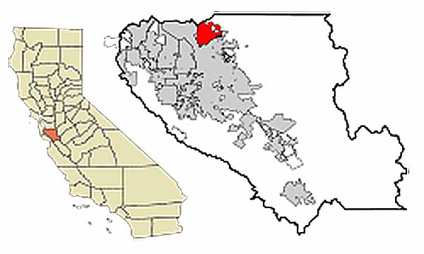
Located in Santa Clara County, south San Francisco Bay Area, California

37n26 (Latitude), 121w54 (Longitude)

13.6 square miles in area

Get Directions

Click here or on the map to be able to zoom in or out, or get directions.

Santa Clara County Quick Facts from the Census
Silicon Valley is defined as being Santa Clara County, at the southern tip of the San Francisco Bay. Milpitas is located on the east side, north end, just south of Fremont, which is in Alameda County. East of of Milpitas is unincorporated ranch land and wilderness. Click the little insert to get an aerial view of Milpitas, or on the Google Earth Map linked below for a clearer view.

City Hall
NE corner of E. Calaveras and N. Milpitas Blvd.
455 E. Calaveras Blvd., Milpitas, CA 95035.

Chamber of Commerce
Turn east into the office complex just south of Shell Gas Station. Once in the front door, turn right. It is a couple of office spaces down on your left.
828 N. Hillview Drive, Milpitas, CA 95035-4401.

Community Center
Site of many town events, and civic meetings.
457 E. Calaveras Blvd., Milpitas, CA. 95035-5411.

Community Library
Community room is just to the right after you pass the first set of doors from the garage, and in the auditorium on the right. Site of a number of meetings including the Milpitas Historical Society.
160 N. Main St., Milpitas, CA 95035-4403.

Google Earth Map of Milpitas
Get a bird’s eye view of Milpitas, zoom in to see the rooftops. Notice all the parks!

Great Mall
Google map showing how to get to the Great Mall and some of its major stores.

Milpitas High School
A bit further north than the star is placed, in the large space to the left. Yahoo Map.
1285 Escuela, Milpitas, CA 95035-3221.

Milpitas Schools
Map showing where the public schools are located. Page includes links to school websites and principals’ email addresses.

Milpitas Unified School District Office, Calaveras Hills High School, Sports Center (Pool, ball fields, new skate park.)
After crossing intersection at S. Park Victoria, turn left into parking lot. For Board Meetings, keep going east to the next parking lot entrance.
1331 E. Calaveras Blvd., Milpitas, CA 95035-5707.

Parks and Recreation Facilities
Addresses, facilities, and maps to all the parks and recreational facilities in Milpitas.

Police Department
Has a community room where some meetings are held.
1275 N. Milpitas Blvd., Milpitas, CA 95035-3153.

Post Office
450 S. Abel, Milpitas, CA 95035-5211

San Jose Airport
Take Montague west, and when it “Y’s” with Trimble, take Trimble left. At the light rail tracks, go left on First Street. Right on Component, up and over 101, which will dump you on Guadalupe. Stay in the right lane for the airport. Make a right into the airport. Be in the right lane for Terminal A, and in the center for Terminal C.

Senior Citizen Center
Large auditorium and stage where number of events are held.
40 N Milpitas Blvd., Milpitas, CA 95035-4323.

Sexual Offenders in Milpitas 
Put “95035” or “Milpitas” into the search fields after reading and verifying disclaimer.