Travel & Transportation

FasTrak in Milpitas

FasTrak and COVID-19 – FAQs

What should drivers do? To drive in the FasTrak lane or not?

Cash is not being collected at Bay Area bridges due to COVID-19. Use FasTrak to pay your toll. If you do not have FasTrak, you will receive a bill in the mail for the amount of your toll. It is called a violation, but there are no penalties – just pay the toll by mail with a check or online. If you have FasTrak, this change does not apply to you.

The I-680 Sunol Express Lanes are designated lanes that can be used during heavy traffic to bypass congestion. Express lanes are usually located on the far-left side of select major freeway corridors (described below) and are indicated with white descriptive text on the pavement and electronic signage above the roadway.

How the heck do I drive along SR-237 now with the new FasTrak lane?

How to Order a Transponder and Use the SR 237 Express Lanes

Step 1: Order your transponder
Step 2: Set up your account
Step 3: Mount your transponder. Transponder mounting help.
Step 4: Use the Express lanes

About Express Lanes

An Express Lane is a portion of a High Occupancy Vehicle (HOV) lane, also known as a carpool or diamond lane, that has been converted to a toll lane in order to better manage congestion. VTA monitors its Express Lanes to maintain a minimum speed of 45 mph, based on federal requirement.

Express lanes are marked by large overhead signage, and smaller signs located in the median. The toll amount is posted on a changeable board within the large overhead sign.

VTA currently operates Express Lanes on State Route 237. Learn more about the planning and history of VTA’s Silicon Valley Express Lanes Program and the 237 Express Lanes project page.

How can I enter the FasTrak lane coming from Milpitas?

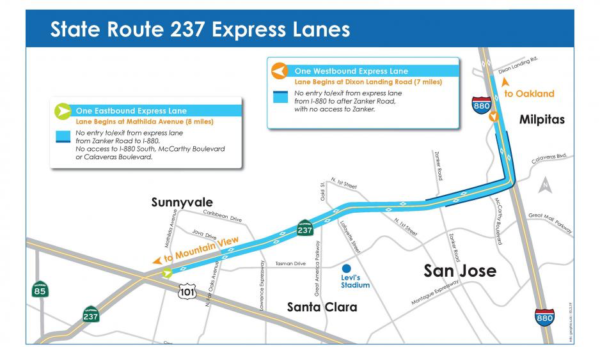
237 Express Lanes

  • Entering from Calaveras Blvd. westbound on SR237 will be a real pain, just as currently. You will not be able to get into the FasTrak lane until just slightly after Zanker, and it ends just before Lawrence. About half your commute will still be in heavy traffic. To avoid the congestion, you might try…
  • Drive north on Milpitas Blvd. to Dixon Landing Rd, and get on 880 south. Get in the HOV lane there as it swings over and onto 237.
  • Take Tasman. Turn right at Zanker. Enter 237 to right just after 237 overpass. Also good strategy for those heading north on 880 wishing to go west on 237.
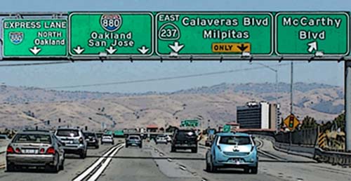
  • Going eastbound on SR 237, there are double white lines west of Zanker Road prior to the 237-880 connector. Express lanes traffic wanting to access I-880 South, McCarthy Boulevard, or Calaveras Boulevard will have to exit the lane at Zanker Road.

FAQs about FasTrak

  • Questions about FasTrak? The FasTrak team is here to help! If you can’t find the information you’re looking for below, please contact us. Our Customer Service team wants you to get the most out of your FasTrak account.
  • FasTrak toll tags are also available to order online.

What hours and days is the Express Lanes operational?

  • SR 237 Express Lanes will now operate from 5:00 am – 8:00 pm weekdays, which is consistent with all other Bay Area Express Lane facilities. At all other times, the lane will be available to regular traffic.
  • Weekends everyone may drive in any lane they want to, with any number of people. FasTrak will not be in force.

What if I have a qualified clean air vehicle?

  • Clean air vehicles (CAVs) with valid clean air vehicle decals can travel toll free or at a discounted rate on Bay Area express lanes and state-owned bridges. In order to receive the correct discount, eligible clean air vehicles should use a FasTrak Flex or FasTrak CAV toll tag.
  • On 237, solo drivers in eligible CAVs will receive a 50% discount off the toll if they use a FasTrak CAV toll tag. The FasTrak CAV toll tag is the only transponder that will communicate the discounted toll rate to roadside toll equipment. Clean air vehicles with two or more people can travel toll free as a carpool, but must use a FasTrak Flex or FasTrak CAV toll tag.

Is it charging me each time it beeps?

  • No. It detects when you enter and leave the lane, and so charges you for total time spent in the FasTrak lane.

How do I know how much I am being charged?

  • Express lanes are free for qualifying carpoolers, vanpool, buses, and other toll-exempt vehicles.
  • For solo drivers with a FasTrak toll tag, the prices to drive to specific destinations will be posted on signs above the the express lane. The toll on VTA’s State Route 237 Express Lanes varies dynamically based on congestion. Minimum will be $0.30 and the maximum will be $8.00.
  • The actual toll deducted from your FasTrak deposit will depend on the total distance you travel in the express lane.
  • Tolls for solo drivers increase with congestion, and decrease with light traffic. But here is an example: the average toll paid by solo drivers in the I-680 Express Lane from Pleasanton to Milpitas in the morning commute period for January 2015 was $3.11, an average of $0.22 per mile over the 14 mile express lane length.

How do they know how many people I really have in my car?

  • Video cameras on the sign posts
  • Vigilant police
  • Setting you make on your tag for 1, 2, or 3+ people. Motorcyclists should leave their setting at 3+.

If I accidentally drive in the FasTrak lane without a transponder what happens?

  • You will get a bill based on your license plate registration. The price is listed on the overhead signs.

Bay Area FasTrak Facebook Page
This is the official Facebook page of Bay Area FasTrak. FasTrak is an electronic toll collection (ETC) system that allows you to prepay your tolls at all Bay Area toll bridges, eliminating the need to stop at the toll plaza. The system has three components: a toll tag, which is placed inside your vehicle; an overhead antenna, which reads the toll tag and collects the toll; and video cameras to identify toll evaders.hicles per hour than a cash lane.

As you pass through a toll lane, the toll tag is read, and your tolls are deducted from your prepaid toll balance. When you reach your replenishment threshold, your account is replenished automatically, if you opened your account with a credit card. If you opened your account as a cash/check account, then you are responsible for replenishing your account by making regular payments.

The FasTrak system tracks your usage and account balance. A monthly or quarterly statement itemizing your bridge use and account balance will be sent to you through the mail or emailed to you.

Train Rides in Northern California

Trains nearby to just ride for dinner and the scenery. Some historic trains take you back in time. Some still require masking, so be sure to have yours along with you.

Niles Canyon Railway

Dinner Trains

Napa Valley Wine Train
The Napa Valley Wine Train takes you on a 36-mile round-trip discovery to St. Helena and back, stopping at celebrated wineries along the way. But it’s more than a train. It’s a luxuriously vintage setting. A lush, mesmerizing landscape. A divine four-course meal. Exclusive insider winery tours. An intimate shared experience.

River Fox Train
A local, family-owned business dedicated to preserving a piece of Northern California history, and providing a wide variety of unique things to do for our community. Our rail line spans 14 miles from West Sacramento to Woodland, and at a leisurely 10 to 15 miles per hour, there’s plenty of time for a cozy dinner, social wine or beer tasting event, or even an entertaining show.

Historic Trains

California Railroad & Trolley Corporation
Trolley rides available at the San Jose Historical Museum.

California State Railroad Museum
Open daily 10am-5pm every weekend April-September, ride behind a steam locomotive on the Museum’s Sacramento Southern Railroad.

Nevada County Narrow Gauge Railroad
Now open Saturdays, 10am-4pm. Began operations 1876 to link the rich mining districts of western Nevada County, California, with the Central Pacific’s trans-continental railroad in Colfax.

Portola RR Museum
Reopen to the public July 1, 2021 at noon. Open Thursdays-Sundays. See link for times. You get to actually be the engineer and drive a real locomotive (under the close supervision of an instructor).

Railtown 1897 State Historic Park
This park unit is open at limited capacity. Please take the time to read the information contained on this webpage to find out what is open and closed, and what COVID-19 guidelines are in place. – (June 24, 2021). Located in Jamestown. Known as The Movie Railroad, Railtown 1897, its historic locomotives and cars have starred in hundreds of film and TV productions, including High Noon, Back to the Future 3, and Petticoat Junction.

Western Railway Museum
The Western Railway Museum is now open! Please book your tickets in advance. Ride or view over 100 interurban, streetcar, rapid transit, electric, steam and diesel locomotives, workcars, and classic heavyweight mainline passenger cars. In Suisun, on Hwy 12, east of I-80.

Yosemite Mountain Sugar Pine Railroad
The Yosemite Mountain Sugar Pine Railroad is a fun-filled excursion for the entire family, located only 10 minutes from the southern entrance of Yosemite National Park off of Highway 41. The historic railroad offers train rides, gold panning, an on-site rail museum, and a fun gifts and collectibles store. Our mission is to inspire learning and fun while experiencing our passion for local history! Open April through November. Fish Camp.

Scenic Train Rides

Roaring Camp & Big Trees Narrow Gauge Railroad
Roaring Camp is open and using Covid-19 protocols. Take a open car train ride through giant redwoods, stop for a picnic and catch the next train back. Take a train from Felton to the Santa Cruz Boardwalk. Participate in historical reenactments. Located in Felton.

Niles Canyon Railway
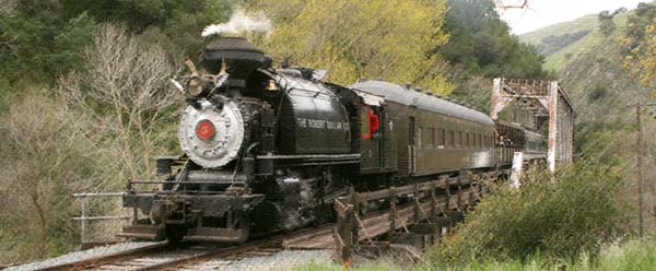
We are thrilled to be back for 2021 and offer a new set of special trips with new opportunities to ride through October 2021 on both Saturday and Sundays. Take a scenic ride on the historic steam locomotive trains and route along Niles Canyon, located between Sunol and Fremont.

San Francisco Cable Cars
Probably the steepest rail rides and in city traffic, too! This site tells you everything from the history to the routes and fares. Try operating the interactive cable car. Cable cars run seven days a week with special schedules on weekends. For a complete updated listing of all cable car stops and time tables, visit www.sfmta.com.

Skunk Train
Step back in time for a magical ride through the redwoods on the world-famous Skunk Train. Since 1885 the historic Skunk has made its way through old-growth redwood groves, over scenic trestle bridges, through spectacular tunnels, and into the heart of the Noyo River canyon. Today’s riders enjoy the same pristine views that have remained largely unchanged for well over a century.
100 West Laurel Street Fort Bragg, California 95437 or 299 East Commercial Street Willits, California 95490

See also: Kiddie Train Rides

Roads & Highways

Find out about road construction plans and delays. Learn what government agencies control these highways. And to relax, enjoy these scenic drives starting in Milpitas, and wandering through our hillsides on backroads.

What is Milpitas known for?
Milpitas is often called the “Crossroads of Silicon Valley” with most of its 13.63 square miles of land situated between two major freeways (I-880 and I-680), State Route 237, and a County expressway.

How far is Milpitas from San Francisco?
The distance between Milpitas and San Francisco is 37 miles. The road distance is 45.9 miles, unless you have a boat to sail between Alviso and San Francisco.

Construction
Governmental Agencies
Scenic Drives

Construction

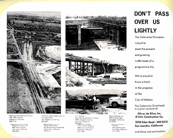
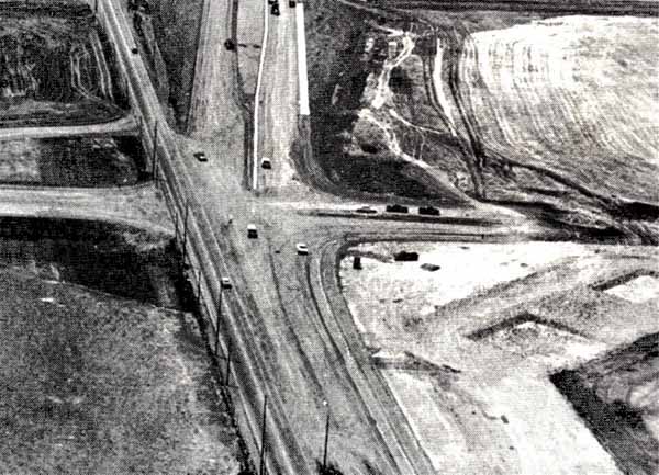
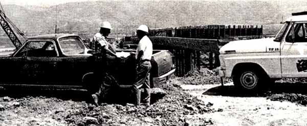
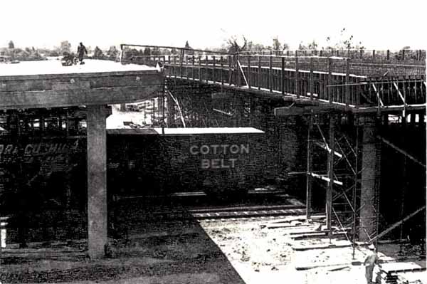
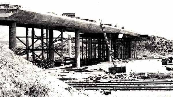
Calaveras Overpass
The Calaveras Overpass is built to meet the present and growing traffic loads of a progressive city. [They thought!]

Montague Expressway Widening
This project widened Montague Expressway to provide for eight through lanes (three through plus one HOV lane in each direction), with bike use shoulders and improved pedestrian sidewalks from Falcon Drive to Pecten Court (approximately 0.8 miles) including replacement of the double-box culvert crossing of Berryessa Creek with a bridge structure.


VTA Montague Expressway Pedestrian Overcrossing
An incredible project RockViewVideo filmed in Milpitas to chronicle the lift & placement of a huge pedestrian overcrossing above Montague Expressway adjacent to the Milpitas BART Station, July 10-12, 2020.

Transportation Information
As a prominent gateway to the Silicon Valley, the City of Milpitas’ Traffic Engineering section has an integral role in maintaining the City’s economic vitality and creating safe and livable neighborhoods that are pedestrian and multi-modal friendly.

Filing a claim against Caltrans
Did you get a nail in your tire in a highway construction zone? Here’s information and the form for filing a claim.

Governmental Agencies

CalTrans
California Department of Transportations, District 4 (includes Santa Clara County). Lots of local information and pictures about Bay Area Bridges.

Metropolitan Transportation Commission
Regional planning group for our highways here in Silicon Valley and around the Bay.

Scenic Drives

Bay Area Backroads
Go “day tripping” to places near and far. KRON TV offers hundreds of ideas in the South Bay Area and further away.


Calaveras Road to Sunol
Calaveras Road varies from 2 lanes in Milpitas and the 84/680 end in Fremont down to 1 lane in the middle. The south half was recently repaved from Milpitas to the Alameda County line, about 2/3 of the entire ride.

Calaveras – Sierra Rd Loop
Scenic drive in the snowy mountains east of Milpitas and San Jose, California.

California Roadside Rest Areas
Plan your rest stops in rural areas.

Main Street History Tour
Joann Souza narrates a tour of Main Street telling about the historic buildings and sites along the way.

Mt. Hamilton Road
Take this mountain road between Alum Rock and Patterson. Do fill up your thirsty steed because if you decide to continue east down the other side of the mountain, it will be another 70 miles to the next gas station. Very windy and steep. Not for the faint-hearted.


Santa Cruz Mountains Roads
A lovely drive is the one through the redwoods from Woodside, over to the coast, down to Santa Cruz, and back over Rt. 9 through Boulder Creek and Big Basin State Park to Saratoga.

Public Transportation – Buses and Light Rail

How to get in, around and out of Milpitas on VTA buses and Light Rail, and also with BART. (See Intercity Trains.)

Access

511.org – Rideshare
Ridesharing benefits include access to the Bay Area’s growing network of carpool lanes, free park-and-ride lots, and a host of commute incentives.

Accessibility and Paratransit Services in Santa Clara County
VTA is committed to providing safe, reliable and convenient bus and light rail service that is accessible to persons with disabilities.

Commuter Benefit Solutions
Commuter Benefit Solutions is a convenient way for businesses to subsidize their employees’ commute to work by public transit and vanpooling.

Discount Fare Card
A regional transit discount card program, which provides substantially reduced fares on Bay Area bus, rail and ferry systems to qualified persons with disabilities and seniors 65 and older. [SFBATI]

Look Up a 511 Stop ID
Need to find a Stop ID for 511’s Phone Service Real-Time Departures? Use the Stop ID lookup tool on this page.

Smart Pass
The Standard SmartPass is valid on all VTA local buses and light rail. The Express SmartPass is valid on all VTA service in addition to the VTA Express bus, Dumbarton Express, Highway 17, and Monterey- Downtown San Jose Express service.

Transit Destinations
A list of the region’s frequently used or most popular tourist sites, government buildings, shopping malls, transit terminals, theaters and other such facilities, along with the transit agencies and routes that serve them. [SFBATI]

Bus & Light Rail

Fast and easy mobile tickets PLUS two hours of free transfers!
With EZfare, you can purchase passes for special events, day passes and single ride fares with two hours of free transfers right on your smartphone. From here you can download the EZfare app from the Apple App Store and Google Play now.

Fares, Passes And Tickets
Exact fare required, operators do not carry change. All Youth and Senior/Disabled/Medicare fares are valid on VTA Express Bus service without an upgrade payment. Children under 5 ride free with adult or parent.

Light Rail Opening 2004
2.6M Slide show movie of the opening of the light rail line at the Great Mall June 23, 2004.

Moovit
Set up to show public transit way to get from Milpitas to downtown San Jose. Edit to go from your home to your destination.

2021 Transit Service Plan
Restoring transit service will be a gradual process and evaluating multiple transit plan scenarios will help us transition smoothly out of “COVID Service” to a 2021 Transit Service Plan.

Español 广州话 Tiếng Việt 한국어 Tagalog

Final 2019 NTSP Map
More area maps here.


MUSD Electric School Buses unveiled at ribbon-cutting ceremony
Apr 28, 2020

Santa Clara Valley Transit Authority (VTA)
Provides bus and light rail service in Santa Clara County, as well as the Hwy 17 Express.

VTA Park & Ride Lots
I-880 Light Rail Park & Ride Lot
Transit Service: Tasman Light Rail, Bus Routes 33, 140, 330, and AC Transit 217
Parking Spaces: 569 (12 Long Term Airport Parking Spaces)

Great Mall Transit Center
Transit Service: Santa Teresa to Alum Rock via Baypointe Light Rail, Bus Routes 33, 46, 47, 59, 66, 70, 71, 77, 104, 140, 180, and AC Transit 217
Parking Spaces: 93
Comments: Shelter, Bench, Bike Lockers, Phones

Milpitas Transit Center & BART Station
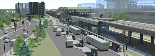
The Milpitas Station is located within Santa Clara Valley Transportation Authority’s Milpitas Transit Center. It is the northernmost BART station in Santa Clara County.
1755 S. Milpitas Blvd.

Milpitas Station is served by:

Need help planning a trip?
For a personalized trip plan with BART and connecting transit, call the BART Transit Information Center.

VTA Schedules, Maps and Fares
We’re here to help you figure out the best route, provide the schedule and fare information you need, map out a personalized transit trip plan just for you, and even put you in touch with others in your area so you can rideshare.

Mail Lists & Activists

Let’s Build Transit Oriented Communities (TOCs)
Signup for regular updates from VTA on the progress of TOCs and related special events. Take their online survey to let VTA know what TOC elements are important to you. Customize your mailings to just one station.

VTA Watch
“Although San Jose and Milpitas are building higher density, the density proposed will not generate enough riders [for BART], and the density needed to generate enough riders will not receive community support.”

Young Professionals in Transportation – San Francisco Bay Area
A Facebook Group for those in transportation in the SF Bay Area.

Planning Commissions

Metropolitan Transportation Commission
The transportation planning, coordinating and financing agency for the nine-county San Francisco Bay Area.

VTA Boards and Commissions
Governing Board of Directors, Bicycle & Pedestrian Advisory Committee, Citizens Advisory Commitee, Committee for Transit Accessibility, Policy Advisory Committee, and Technical Advisory Committee.

Programs

CalTrans Office of Local Programs
The purpose of Local Programs is to assist local agencies taking advantage of state and federal funded transportation programs.

Emergency Ride Home Voucher
With the ERH, commuters at participating employers using a rideshare mode (e.g., public transportation, carpool, vanpool, etc.) can count on a ride home in the event of a personal illness, unscheduled overtime, or other qualifying personal emergencies. Print out and use this form for your taxi.

Kiddie Train Rides

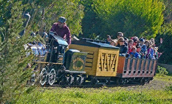
Take the kids on fun pint-sized train rides near Milpitas, in the San Francisco Bay Area and beyond.

Bianchi Train
Beloved tiny train gives rides in San Mateo’s Central Park. According to the sign, it runs weekends only except from Jun 15-Aug 15, when it runs weekdays from 10 to noon, otherwise Sat and Sun from 11 to 1. Also, the train does not run in bad weather (cloudy/raining). The city park website does not list the correct hours, but does list a number to call in advance to confirm hours of operation: 650-340-1520

Billy Jones Wildcat Railroad
Vasona Park, Los Gatos. There are two locomotives, the primary one, Number 2, is a 1905 vintage steam engine of the 2-6-2 prairie type, weighing approximately four tons. Runs year ’round, unless it’s raining too hard. 233 Blossom Hill Road, Los Gatos, CA 95032.

Casa de Choo Choo
Casa de Fruta’s Narrow Gauge Railroad is fun for children of all ages. The two-mile long track meanders through the complex, passing along scenic Pacheco Creek, past the zoo and the enclosure that is home to peacocks and rare white deer that originated from William Randolph Hearst’s San Simeon menagerie. For the train rides’ schedule, call 408-842-9316.

Confusion Hill
The 30-minute train ride (more or less… it seems to depend on how actively the passengers interact with the engineer!) starts at the “station” atop a couple flights of stairs behind the gift-shop/ticket office. Piercy, Mendocino County, 75001 N. Hwy. 101.

Golden Gate Live Steamers
Located in Tilden Park in the hills above Berkeley, California, the Golden Gate Live Steamers is a 501(c)(3) non-profit museum whose mission is to operate a miniature live steam railroad, to teach, inform & promote model engineering craftsmanship for the benefit of our members and to educate the public on what live steaming & model engineering is all about.

Happy Hollow Park & Zoo Rides
Ride the “Danny the Dragon” train. Happy Hollow has new rides that will be sure to delight all ages. Please be aware of the height requirements and other restrictions for each ride. In some case an adult will be required to ride with a child that doesn’t meet the minimum height requirements.

Little Puffer
Little Puffer

Little Puffer
This 22-gauge Class “E” Cagney miniature train has given California children rides for about a century. It currently operates at the San Francisco Zoo. Come take a ride!

Outback Express Adventure Train
Like the Little Puffer, this train is located at the zoo—the Oakland Zoo, in fact. But, you can access it without buying zoo admission. You will still get a little glimpse of the wildlife: the train travels through the Australian exhibit (hence the name) and emus occasionally try to make a break for it when the gates open to let the train through. The ride is affordable at $3/person over the age of 2, however, you will still have to pay to park at the zoo. 9777 Golf Links Rd. Oakland, CA 510-632-9525.

Redwood Valley Railway
Train rides along a scenic ridge on a scaled-down steam train. For information, including hours and ticket prices, call (510) 548-6100. 2501 Grizzly Peak Blvd & Lomas Cantadas, Orinda, CA 94563

Sonoma Train Town
Train Town is located on 10 acres with one and a quarter miles of track. Scale is 3″ to a foot. Upon arrival at Lakeview you can stretch your legs and visit the petting zoo.

SPCRR Train Rides & Museum at Ardenwood
The Railroad Museum operates scheduled train rides on Thursdays, Fridays, and Sundays from April 1st until the weekend before Thanksgiving. 34600 Ardenwood Blvd, Fremont, CA 94555

See also:

Intercity Trains

Amtrak
Check here for reservations, trains and destinations, special savings and promotions, plan your trip, and more.

Altamont Commuter Express
On ACE, you can sip coffee, read the paper or work on your laptop during your commute. There’s a place to store your bike, a table to spread out paperwork, and clean, accessible bathrooms can’t find those in a car! Weekday Schedule. View train status alerts or have them sent by text message.


Caltrain: Local and Baby Bullet Trains at San Jose Diridon

Baby Bullet
From the San Francisco to the San Jose terminals, travel time will be cut from an hour and 36 minutes on a local train to just 57 minutes on the Baby Bullet.


VTA’s BART Silicon Valley Berryessa Extension Opening Ceremony

BART – Bay Area Rapid Transit
General information, schedules, phone numbers, fares, maps, connections. Handy site. Line schedules.

BART Map Includes Milpitas
The Milpitas and Berryessa BART stations are getting ready for business, with sights set on June 2020 for the official opening date.


BART Silicon Valley Extension
An extension of the existing BART system to San Jose, Milpitas and Santa Clara. This project will extend the current system 16 miles along the existng Union Pacific Railroad corridor south of the future Warm Springs Station in Fremont.

BayRail Alliance
An all volunteer transit consumer group working to realize a regional rail system that will ring the San Francisco Bay Area.

CalTrain
Select where you start and end your journey, enter time range. Next page gives you fare, length and duration of your trip, info about the stations. Find out about service to Giants games.

Capitol Corridor Intercity Rail Service
Eighteen train trips daily supported by connecting feeder bus services serve 172-mile rail corridor, which includes stops in Auburn, Rocklin, Roseville, Sacramento, Davis, Suisun City-Fairfield, Martinez, Richmond, Berkeley, Emeryville, Oakland, Hayward, Fremont-Centerville, Santa Clara-Great America; and San Jose.

Calaveras Overpass

Don’t Pass Over Us Lightly!

The Calaveras Overpass is built to meet the present and growing traffic loads of a progressive city. [They thought!]

We’re proud to have a hand in the progress of the City of Milpitas.

The Calaveras Overhead is a joint venture of:

Oliver de Silva, Inc.
& Liton Construction Co.
233 Eden Road – 569-5313
San Leandro, California

Air Travel

How to get to Milpitas and how to leave it via air travel. Most use SJC out of San Jose, as the closest airport to Milpitas.
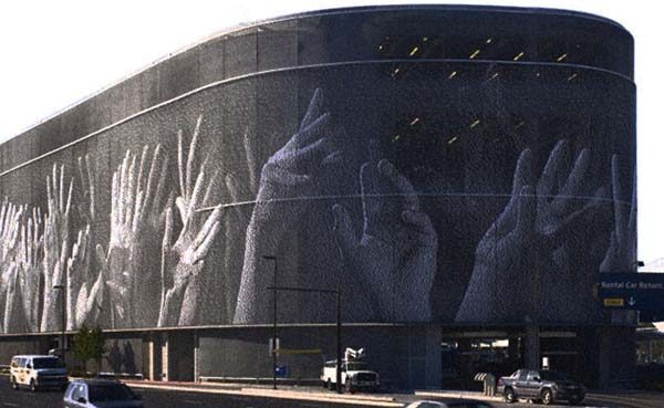
SJC Hands

Airlines

Airlines at the Norman Y. Mineta San Jose Airport
Page with the links to each airline, where you can find flight information.

Airplane Manufacturers

RnR Products
Our all composite miniature aircraft have flown the world including the first UAV to cross the Atlantic non-stop! 1120 Wrigley Way, 408-946-4751.

Airports

Norman Y. Mineta San Jose International Airport
Located five miles southwest of Milpitas, San Jose International Airport (SJC) is the closest air service for visitors to travel to and from Milpitas.

Airlines and Flights
This section contains a listing of all airlines servicing San Jose International Airport, their terminal locations, toll-free numbers and Web addresses. Reference our on-line Flight Guide to help you plan your air travel. If you’re checking on an arriving flight, you’ll find a link to Real-Time information with TheTrip.com’s Real-Time Flight Tracker.

To & From SJC
Come and go as you please. This section provides information on maps and directions, parking, meeting passengers, rental cars, taxis, rideshares, public transitdoor-to-door shuttles, hotel shuttles, limousines, scheduled buses, and bicycles and pedestrians.

Passenger Services
Here you’ll find a listing of all the maps of the Airport. These maps will help you locate all the services the Airport has to offer, including: restaurants services and amenities, shops, things to do, public art, and accessible services.

Cargo and Freight
Need information on shipping? This section contains names, toll-free numbers and Web addresses of all cargo carriers servicing San Jose International Airport.

About SJC
There’s more to the Airport than you might have imagined. This section is a compendium of news and information, including employment opportunities, and news releases.

Community and Environment
San Jose International Airport is involved with the community on many levels. This section provides links to the various areas of involvement such as the Noise Abatement, Curfew Monitoring, and Flight Tracking Program with a 10-minute delay.

Oakland International Airport
North of Milpitas about 30 miles. 2nd preferred airport, should you not be able to fly into San Jose.

San Francisco International Airport
The Airport is known as the Gateway to the Pacific for its premier position as a point of departure to many destinations in the Pacific Rim. Find airline flight schedules to and from SFO; ground transportation services; airport terminal guide; and airport parking. Kiss and Fly drop off area.

Planning

Airport Expansion Plans
How might airport expansion affect quality of life in the area. Metro story.

CAAPSO
CAAPSO is a collaboration of interested parties that want to maintain Reid-Hillview (RHV) airport as a vibrant resource for the general aviation community and a benefit to the local community. CAAPSO stands for what we believe in: a Community And Airport Partnership for Safe Operations.

How to stop commercial air hijackings without inconveniencing air travelers
I’ve listed many suggestions below for both increasing security and making the plane a less attractive with minimal passenger air travel inconvenience. Many can be implemented immediately, at virtually no cost. Steve Kirsch

Shuttle Service

Airport Parking Reservations
We’ve done the shopping and negotiated great parking rates for you. We offer you a selection of safe and secure parking operators within 5 minutes of the airport.

Public Transportation to San Jose-Mineta Airport
The Route#60 service schedule has temporarily reduced frequency, running every 20-minutes between the hours of 5:30 AM and end service after 9 PM, 7 days a week. Route #60 will continue to offer free rides from the airport, with a minimal fee to ride into the airport, or free with a transfer pass to the Milpitas Bart Transit Center and the Winchester Transit Center.

Shuttle companies
All over the Bay Area offer airport-to-door service to SJC. Discounts are offered for groups of 2 or more being picked up at the same location. List with phone numbers.

Travelers’ Information

City Hall will now accept Passport Applications
A benefit to residents, the move will also provide additional and much needed revenue. The City of Milpitas will be receive $30 for each processed passport. Applications will be accepted Monday-Thursday, 9a – 3p, and Fridays by appointment. Call the City Clerk’s Office for more information: 586-3001.

Applying For Passports
You may apply for passports at the County of Santa Clara, Office of the Recorder, mornings between 8 a.m. and noon.

Flight Aware
Live current status of any flights between major cities within the United States.

International Travel Information
Travel Warnings are issued when the State Department decides, based on all relevant information, to recommend that Americans avoid air travel to a certain country.

Security Procedures
The Transportation Security Administration (TSA) manages airport security. Visit the TSA website to find up to the minute security procedures and how to best prepare for your next flight.

See also Flying (Recreational Flying)

Clean Air Incentives in Milpitas and California

Making Clean Cars Easier to Buy in California

Clean Vehicle Rebate Project | Center for Sustainable Energy
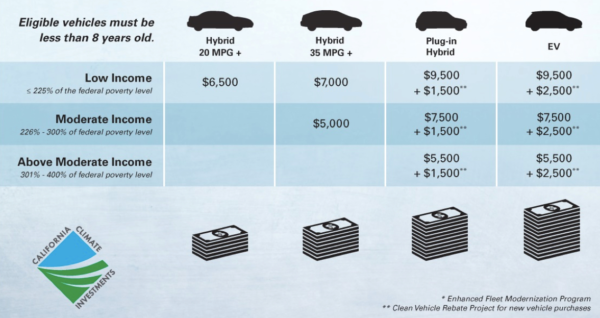
California residents get up to $7,000 for the purchase or lease of a new, eligible zero-emission or plug-in hybrid light-duty vehicle. As of June 5, 2019, funding is only available for qualified lower-income applicants, as described here. All other applications for vehicles already purchased/leased will be processed and placed on a rebate waitlist. Qualified applicants on the rebate waitlist will receive payment if the project receives more funding from the State of California.

Drive Clean | Plug-in Electric Vehicle Resource
The cost of plug-in electric vehicles at first glance may seem high. But, factor in the different rebates and tax credits available, and the cost becomes quite attractive. Search incentives by your zipcode (95035) and you may find even more programs that will save you money.

Incentives | California Air Resources Board
Financial incentives are a key part of California’s efforts to ensure cleaner cars, trucks, equipment and facilities are operating in our neighborhoods. Incentives help drive the development of new, cleaner technologies and, by speeding up their sale and adoption, help clean up the air.

Vehicle BuyBack Program
The Vehicle Buy Back Program will pay Bay Area residents $1,200 to turn in their operable, registered 1997 or older vehicle for scrapping.

Report Smoking Vehicles
You may report smoking vehicles with California license plates seen in these nine San Francisco Bay Area counties: Alameda, Contra Costa, Marin, Napa, San Francisco, San Mateo, Santa Clara, Solano and Sonoma. You may also call 1-800-EXHAUST.

Research on Transportation Choices
Our low carbon transportation choices research program seeks to: 1) improve our understanding of household transportation and vehicle choices, 2) understand market forces, consumer acceptance, and real-world emission benefits of new and used plug-in electric vehicles and fuel cell electric vehicles, and 3) increase the adoption of clean vehicles across households of all income levels and optimize equitable distribution and return on investment of clean vehicle incentives.

Top Clean Cars for 2019 and 2020
By Josh Goldman, Senior policy and legal analyst. Electric vehicles were prominently displayed at this year’s auto shows; for good reason. EVs are cheaper and cleaner to drive than their gasoline-powered counterparts and are beginning to appear as SUVs and pickups, which are the most popular vehicle types in the U.S. Want to find out how clean an EV is in your area? Check out this handy emissions calculator.

Transportation Fund for Clean Air
TFCA’s goal is to implement the most cost-effective projects in the Bay Area that will decrease motor vehicle emissions, and therefore improve air quality. Projects must be consistent with the 1988 California Clean Air Act and the Bay Area Clean Air Plan.

Trump Administration Dramatically Reduces Penalties for Auto Inefficiency
July 16, 2019. In a Friday news dump last week, the Trump administration announced that they will be finalizing a reduction in fines for missing fuel economy targets. Not only is the administration working to roll back the strong standards set in place by the previous administration currently driving efficiency improvements across new vehicles, but now they are letting automakers off the hook if they miss targets between now and when that rollback goes into effect.

em>See also ~ Vehicles – Shopping, Sharing, and Service for Cars in Milpitas

History of Transportation near Milpitas

Milpitas is best known for the Ford factory that made the classic Mustangs. Silicon Valley was once the terminus for the Transcontinental Railroad, too. On this page you can find out more about the fascinating role this area played in the history of transportation for the region and the world.

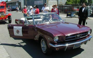
Mustangs in the parade
Lots of Mustangs in the parade as these cars were once made at the Ford Factory in Milpitas.

Pick your favorite means of transportation!
Automobile
Aviation
Bridges
Railroads
Roads
Shipping & Port History

Automobile

Blackhawk Automotive Museum
A ‘hands off’ collection of cars that were museum pieces right from Day 1 and a collection of fine art that has the automobile as its subject.
3700 Blackhawk Plaza Cir, Danville, CA
925-736-2280

The Great Mall holds a great Ford secret
Ford’s Milpitas Plant is now a shopping center known as The Great Mall. It was the birthplace of the Skyliner hardtop convertible, entry-level Edsels, and the three generations of Mustangs (including all of the 1965-67 cars that would become Shelby GTs). And today this former factory still has a secret hidden within its retail walls. Rather fun to read the comments, too.

Aviation

Hiller Aviation Museum
A collection dedicated to man’s concept of flight. Museum exhibits highlight the many historic advancements native to Northern California, and show how technologies resident here today will shape the future of air transportation. San Carlos.


The Jet Age Video produced in 1962 by W.A. Palmer. Showing construction of the South Field Oakland airport.

Oakland Aviation Museum
The Museum’s facilities are located in a vintage hangar at Oakland International Airport’s historic North Field.

Silicon Valley Pride: Norman Y. Mineta San Jose International Airport
Compared to San Francisco and Oakland, San Jose was slow to even acquire land for an airport; barnstormers and the like used the private fields surrounding the city.

Bridges

Bridging the Bay
The bridges documented include the Golden Gate Bridge, the San Francisco-Oakland Bay Bridge, the Carquinez Bridge, the Richmond-San Rafael Bridge, the Antioch Bridge, and the Dumbarton Bridge. The exhibit also contains documents detailing Bay Area bridge projects that were seriously considered, but were never built.

Impossible – The San Francisco Oakland Bay Bridge
The distance was too great, the tides too swift, the Bay too deep-and the bottom of the Bay was mud and silt, unsuitable for anchoring piers, but they managed to build it anyway.


The New East Span of the Bay Bridge
The replacement of the East Span of the San Francisco-Oakland Bay Bridge is the largest, most visible and challenging public works project Northern California has seen in decades.

Symphonies in Steel: Bay Bridge and the Golden Gate
Within the 450 square miles of landlocked harbor, San Francisco Bay has eight major highway bridges, including four of the world’s greatest steel bridges, as well as two railroad bridges. By John Bernard McGloin, S.J., Professor of History, University of San Francisco.

Railroad

History of Railroads in California
History of the California end of the Transcontinental Railroad, and other historic trains and historic railroads in the San Francisco Bay Area.

Roads

CA Department of Motor Vehicles History of CA DMV
Essentially, Californians were anxious to police motorists and protect themselves with a formidable barrier of “rules of the road.” The secretary of state was empowered in 1905 to register and license motor vehicles.

The History of Traffic Signing in California
The early days of motoring in California were an adventurous ordeal. Most routes were unmarked, not paved, and traffic signs were basically nonexistent.

History of I-680
70.5 miles from I-80 near Fairfield, south through the Diablo Valley, and ending at US 101/I-280 in San Jose. The Pleasanton-San Jose commute is now the South Bay’s most congested, because of increased residential development in the Pleasanton Area leading to jobs in Silicon Valley.

History of I-880
44.70-mile Nimitz Freeway; from I-280 in San Jose to I-80 in Oakland. On the Spanish news stations, the name is contracted to “Ochochenta.” Named after WWII admiral Chester W. Nimitz.

Lincoln Highway History
The Lincoln Highway was established in 1913 as the first highway across the United States. Unlike the highways of today, the Lincoln was very narrow, unpaved in many places and not straight as an arrow. Route in California.

Santa Clara Valley Mill & Lumber Company – 1870’s
The demand for firewood and building lumber by the citizens and towns of the Santa Clara Valley produced a road over the summit from Saratoga to the San Lorenzo Valley in 1870.

Shipping & Port History

Alviso
The earliest use of Alviso Slough as a shipping port was recorded by John Henry Dana in his book “Two years before the Mast.” Mission Santa Clara shipped cowhides and wheat during the 1830’s.

History of Vallejo Ferry Service
In 1986 Marine World/Africa USA moved to a spacious new location in Vallejo from Redwood City. San Francisco tour boat operator, Red & White Fleet began a ferry service to Vallejo and bus service carrying commuters to San Francisco in the morning and bringing visitors to Marine World during the midday and on weekends.

Maritime Heritage Project
As long as there have been floating vessels, mariners have found safe harbor in San Francisco Bay, beginning with the first people in the Americas thousands of years ago.

Port of Oakland History
Home base for Jack London’s sailboat Razzle Dazzle and his fellow teen-age “oyster pirates.” His favorite saloon, Heinhold’s First & Last Chance, still stands today at Jack London Square. First port to renovate for container shipping. Cranes inspired huge waling robots in Star Wars movies.

Port of San Francisco History
Born out of the Gold Rush, today’s Port of San Francisco is a public agency responsible for managing the 7-1/2 miles of San Francisco Bay shoreline stretching from Hyde Street Pier in the north to India Basin in the south.